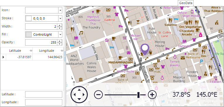
Screenshot and Field Descriptions: GeoData Tab
Icon: this is what will show as the icon for the property when displayed on the map. Leave blank to use the default. If required, edit values in the Stroke, Width, Fill and Opacity fields to change how the icon will look.
Latitude / Longitude table: this contains rows of latitude and longitude co-ordinates. Double click a row to populate the fields below the table for editing.
The values in the following fields can be Added, Changed and Deleted using the Maintenance Push-Buttons (Right Hand Side).
Latitude: this is the geographical latitude of the property in decimal format. Southern hemisphere positions should be negatively prefixed.
Longitude: this is the geographical longitude of the property in decimal format. Positions West of Greenwich should be negatively prefixed.
The latitude / longitude values for an address can be found by either clicking on the Map or by clicking the Application tool-bar push button: Geocode.
Screenshot and Field Descriptions: Geocode
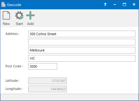
Address / Post Code: this is the address for the property.
Latitude: this displays the latitude for the given address.
Longitude: this displays the longitude for the given address.
How Do I : Get the Latitude / Longitude values for a Property address